
IFCN lists PR 8 as open on 28 October 2026. Visit Madeira notes minor temporary diversions marked with signs and arrows; follow them. Official IFCN list →
Vereda da Ponta de São Lourenço
A moderate, undulating 4 km (one way) coastal walk for anyone comfortable on uneven ground in full sun; book a slot and bring water, as there is no shade.
- Distance
- 4 km
- Time
- 2 h 30 min
- Difficulty
- Moderate
- Route
- Out and back
Map and elevation
The GPX track and elevation profile will appear here once we have walked and recorded it.
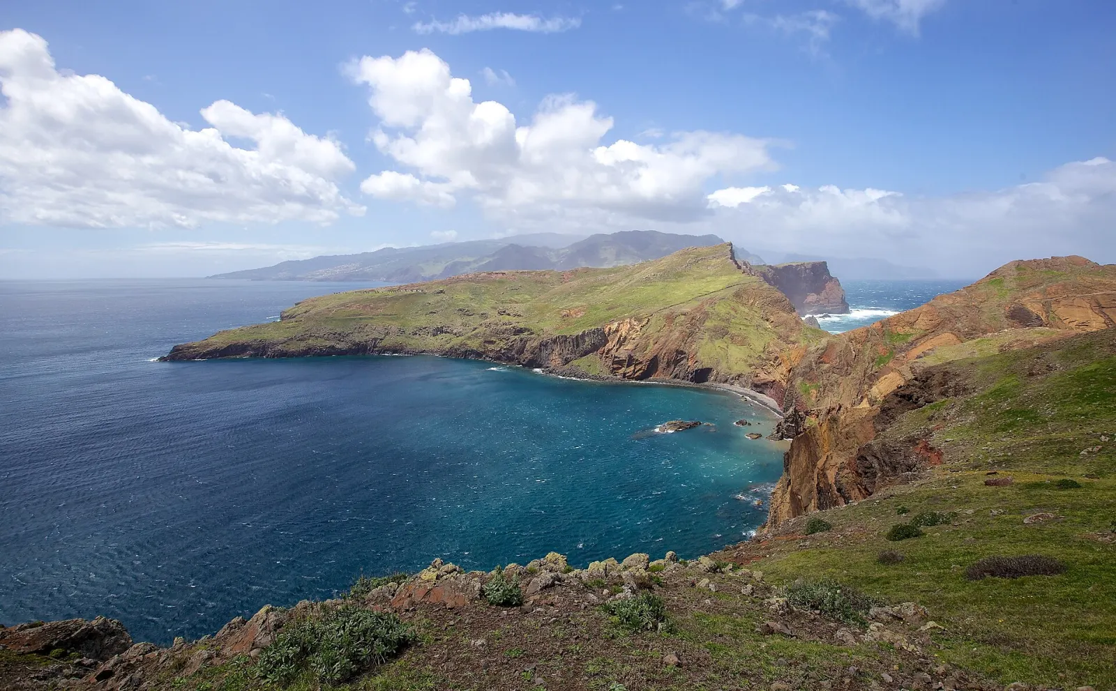
Vereda da Ponta de São Lourenço (PR 8) is the official IFCN trail along Ponta de São Lourenço, the easternmost peninsula of Madeira, near Caniçal in the municipality of Machico. It runs 4 km one way from Baía d'Abra to Casa do Sardinha and back on the same path (8 km in total), with an official estimate of 2 h 30 min. It is the island's best walk for seeing Madeira's bare, volcanic eastern tip, with sea on both sides.
How long and how hard is PR 8?
| Official value | |
|---|---|
| Distance | 4 km one way + 4 km return (IFCN route list, 2026) |
| Duration | 2 h 30 min (IFCN estimate) |
| Difficulty | Moderate (Visit Madeira) |
| Highest / lowest point | 126 m / 23 m |
| Start / end | Baía d'Abra / Casa do Sardinha |
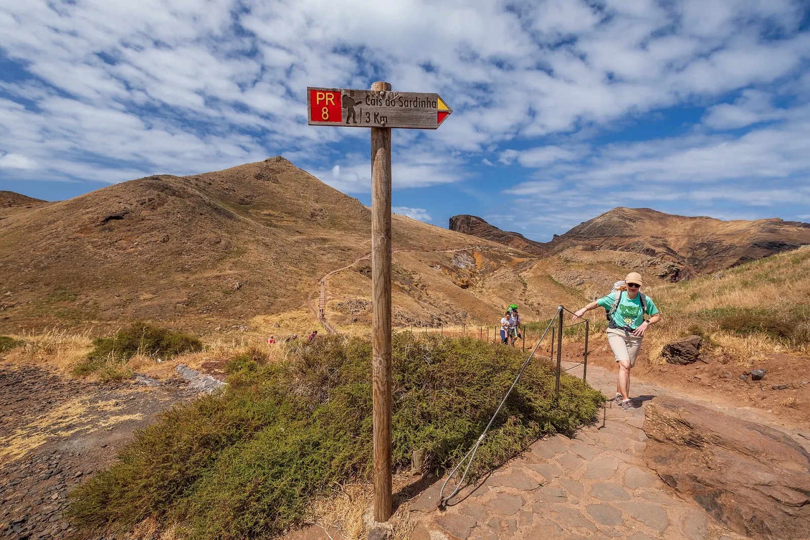
The path is undulating rather than steep, but it climbs and drops repeatedly. The older trailhead panel still prints 3 km; IFCN's current route list gives 4 km each way, which is the figure used here.
What makes the landscape different?
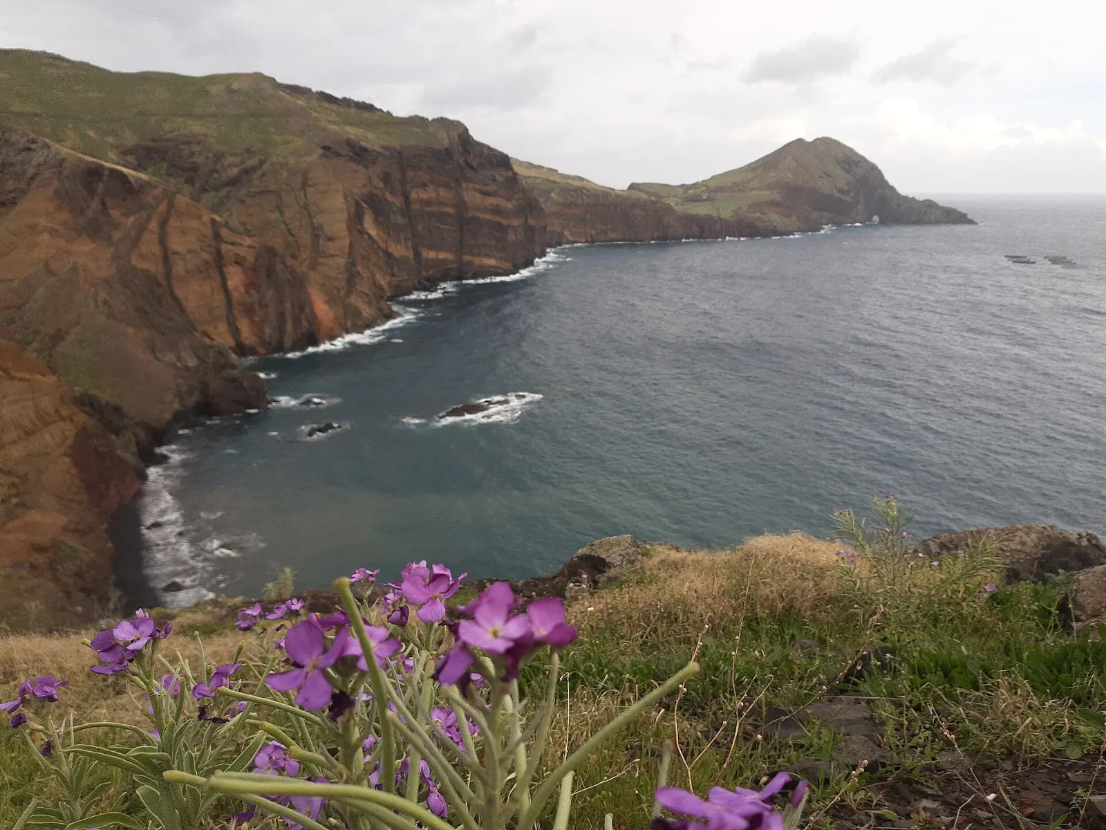
The peninsula is of volcanic origin, mostly basalt with some limestone sediment. According to IFCN, its semi-arid climate and exposure to north winds explain the low vegetation and the total absence of trees, a sharp contrast with the laurel forest of the island's interior. Two islets sit off the tip: Ilhéu da Cevada (also called da Metade or dos Desembarcadouros) and Ilhéu do Farol, which carries the lighthouse.
The whole area beyond the stone wall at Baía d'Abra belongs to the Madeira Natural Park. The peninsula is a partial nature reserve, the Desembarcadouro islet is an integral reserve, and the land plus the sea off the north coast down to 50 m depth are part of the Natura 2000 network. The headland is also an Important Bird Area for its seabird colonies, including one of the largest gull colonies in the region. With luck you may see the Mediterranean monk seal (lobo-marinho) offshore. On clear days the Desertas islands are visible to the south and Porto Santo to the north.
Booking, fee and status
PR 8 is managed by IFCN and is part of the paid, time-slot system: book on the SIMplifica portal before you go. In 2026 the fee for visitors is €4.50 per trail; children up to 12 and Madeira residents are exempt, but registration is still mandatory. IFCN only refunds or reschedules when it officially closes or restricts the trail, not for rain or a change of plans. Details are in our trail booking and fees guide. On 28 October 2026 IFCN listed the trail as open; Visit Madeira mentions minor signed diversions.
How do you get to Baía d'Abra?
By car, follow the regional road east past Caniçal to the end of the road at Baía d'Abra, where the trail starts beside the parking area. By public transport, CAM route 702 Funchal / Caniçal – Baía d'Abra (numbered 113 before March 2026) serves the trailhead; check the current timetable on SIGA before relying on it. See getting around Madeira without a car.
What do people commonly misjudge?
- Heat and wind. There is no shade and no tree cover at any point. IFCN asks walkers to carry water.
- Cliff edges. IFCN warns that in many places the ground near the cliff is unstable. Stay on the marked path.
- Total time. The official 2 h 30 min does not include long stops at the viewpoints or a swim at Cais do Sardinha.
Combine it with
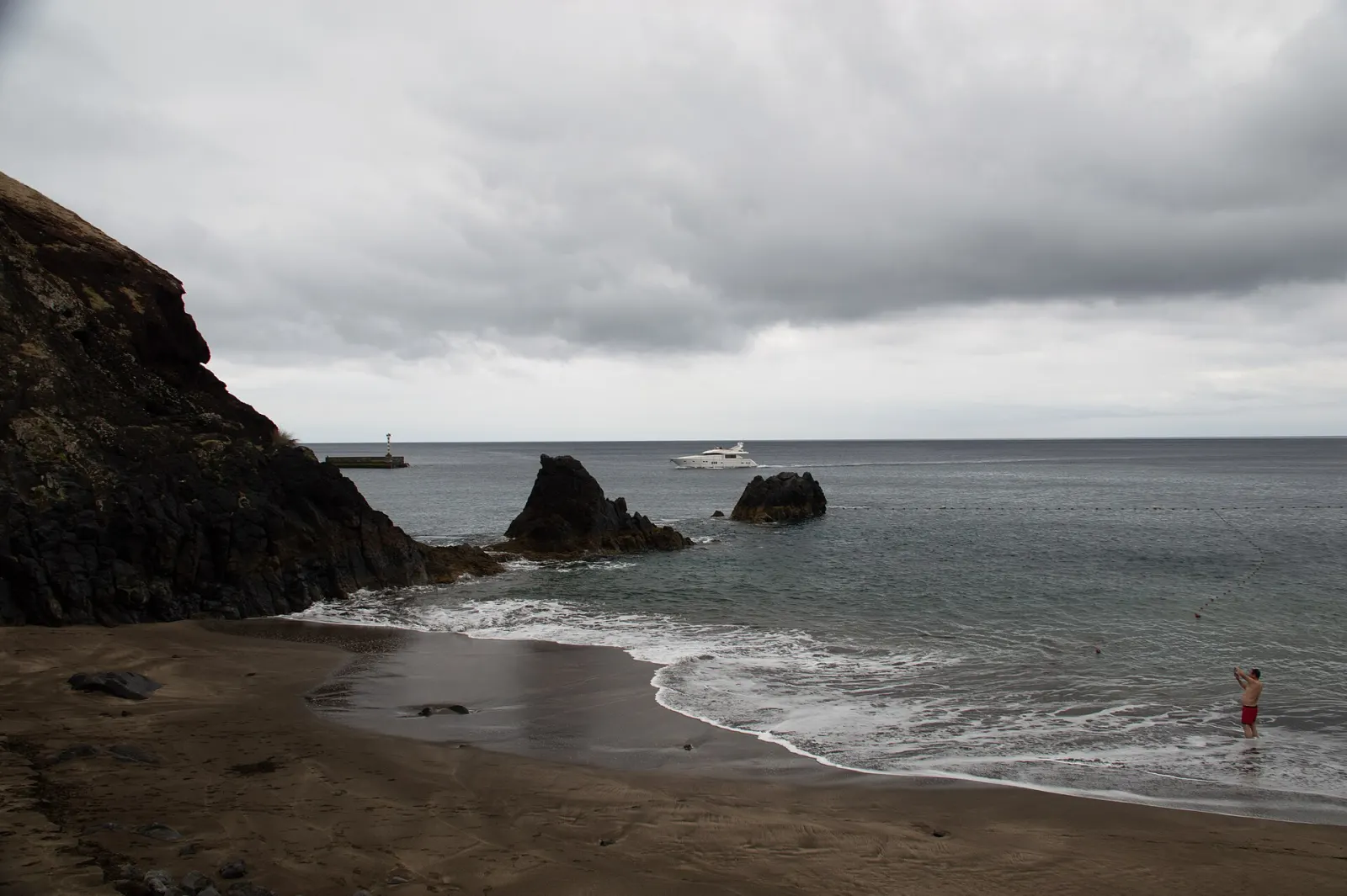
The trail is the natural centrepiece of a day in the east of Madeira. Prainha do Caniçal is in the same Caniçal area for a stop on the way back, and the 3-day essentials itinerary shows how the east fits into a short stay.
The route, step by step
- 1 Baía d'Abra trailheadThe trail starts at the end of the road at Baía d'Abra, with parking, a bus stop and an IFCN information panel. Have your SIMplifica booking ready.
- 2 Into the Natural ParkBeyond the stone wall of Baía d'Abra the land belongs to the Madeira Natural Park. The path undulates along the ridge with views over both the north and south coasts.
- 3 Viewpoints over the north cliffsSeveral marked viewpoints look down on the eroded volcanic cliffs and basalt dykes. Stay on the path: IFCN warns the ground near the edge is unstable in many places.
- 4 Casa do SardinhaThe official end point, 4 km from the start, near the small Cais do Sardinha quay, where Visit Madeira suggests a swim. The lowest point of the route (23 m) is here.
- 5 Return to Baía d'AbraWalk back the same way (another 4 km). Allow time: the return includes the same climbs as the outward leg.
Before you go
Make a day of it
Within 2 km of the trailhead.
Sources and fact-checking
Facts checked against the sources below on 28 October 2026. How we work
- IFCN — Classified walking routes: list, distances and current status (checked 2026-10-28)
- IFCN — PR 8 Vereda da Ponta de São Lourenço official trail panel
- IFCN — FAQ: fees and bookings for classified walking routes (2026)
- Visit Madeira — PR 8 Vereda da Ponta de São Lourenço
- Wikipedia — Ponta de São Lourenço
- SIGA — New bus route numbering in force from 9 March 2026 (PDF)
Photos: Sergey Ashmarin (CC BY-SA 3.0) · Gerda Arendt (CC0) · Ximonic (Simo Räsänen) (CC BY-SA 4.0)